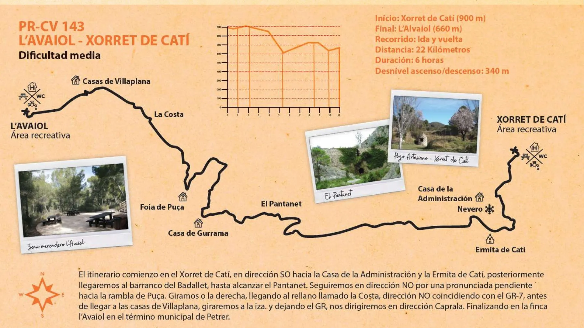
The itinerary begins at Xorret de Catí, heading southwest towards the Casa de la Administración and the Ermita de Catí; afterwards we reach the Barranco del Badallet, until we come to the Pantanet. We continue northwest up a steep slope towards the Rambla de Puça. We turn right, reaching the flat area known as la Costa, heading northwest along the GR-7. Before arriving at the Casas de Villaplana, we turn left and, leaving the GR, head towards Caprala. We finish at the l'Avaiol estate, in the municipality of Petrer.
StartXorret de Catí900 m
EndL'Avaiol660 m
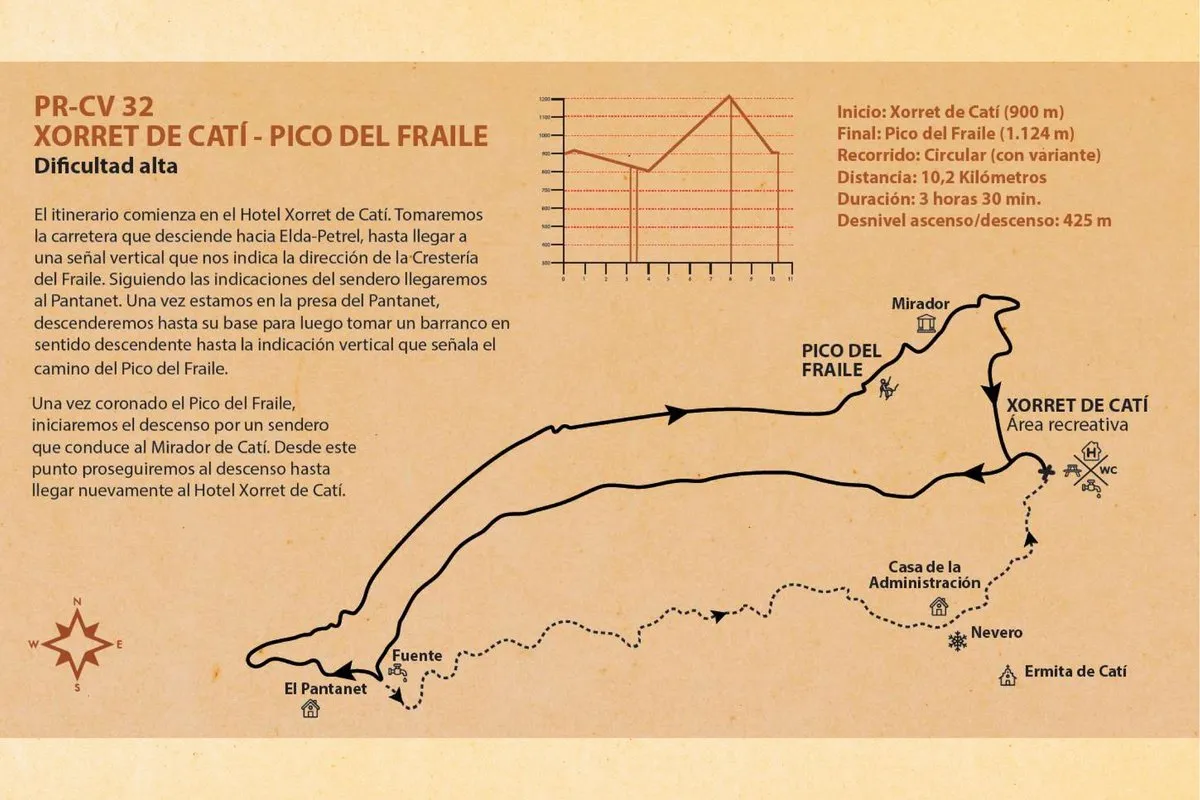
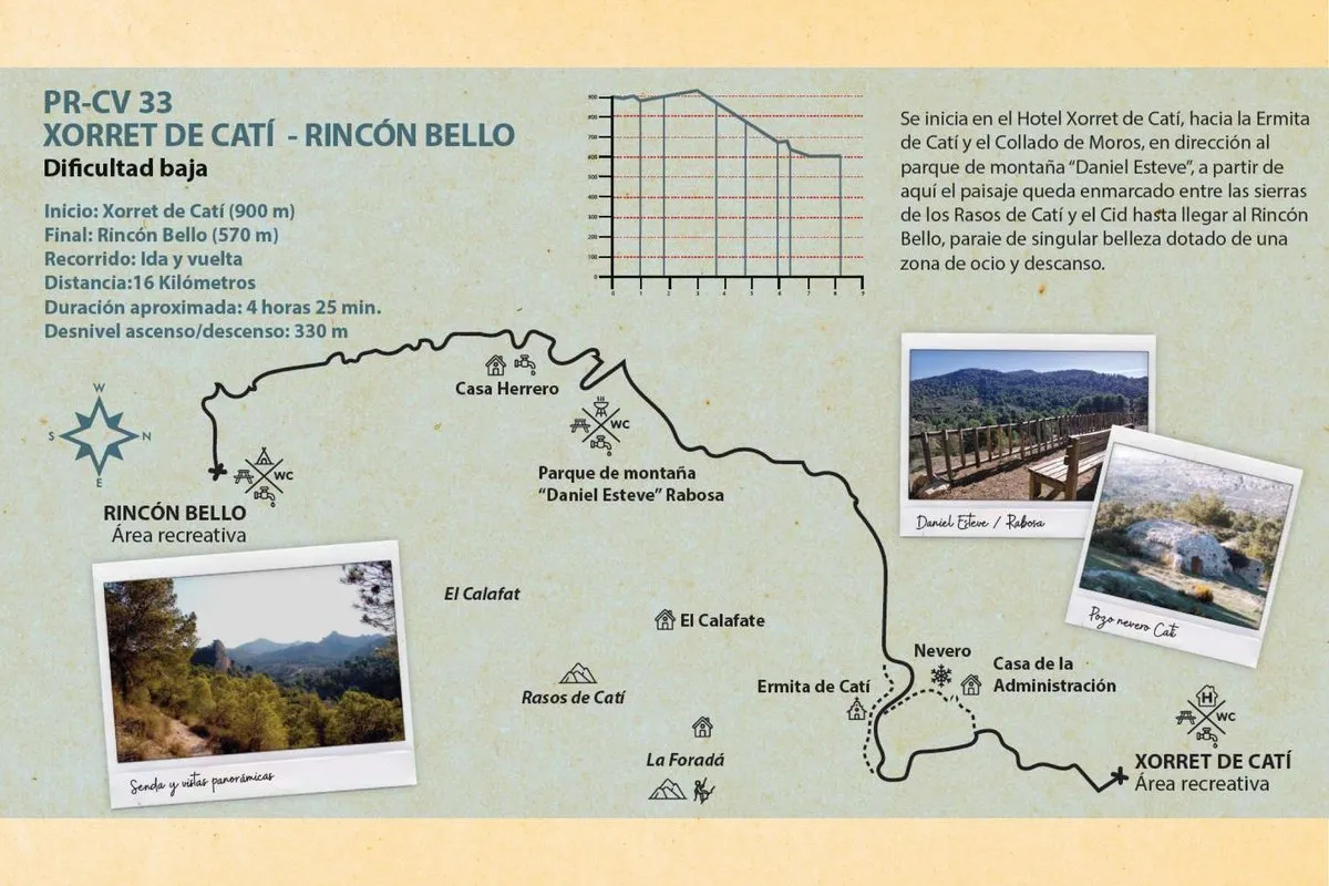
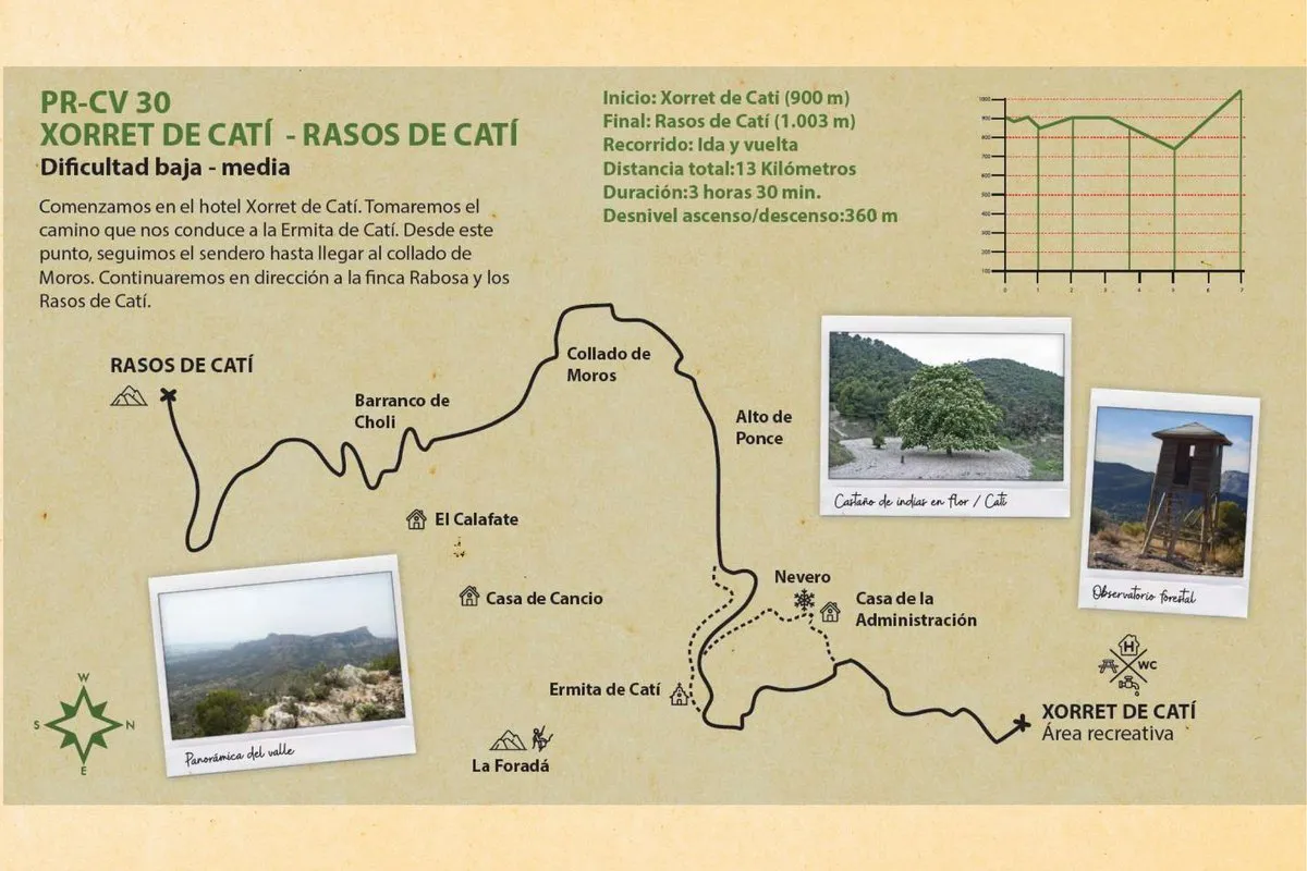
Terrain profile
Elevation
Approximation based on the official Petrer en Verde mapping.